Location


Final Details
Many thanks to the Wildcat Centre in Newtonmore for permission to use the images of their painted cats for the String Courses. There are around 100 cats dotted about Newtonmore (can you spot them?) and a 6 miles Wildcat orbital trail round the village. More information from the Wildcat Centre opposite the post office.
Please support the cafes and shops in Laggan, Newtonmore and Kingussie. They know about the event and will give you a warm welcome.
Important Information
- Organising clubs
- GRAMP, RR, BASOC
- Organisers
- Paul Duley (GRAMP), Tim Darlow (RR)
- Planners
- John Tullie & Eb Rooney (RR), Helen Rowlands (GRAMP)
- Controllers
- Trevor Hoey (FVO), Tim Griffin (GRAMP), Ted Finch (FVO, IOF Advisor)
- Directions
- A82 towards Inverness (10 miles) and then A86 towards Newtonmore (36 miles) before turning left into field (GR NN699979)
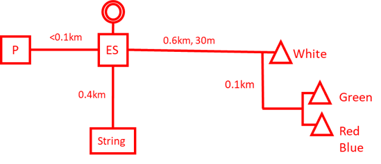
- Parking (P)
- Flat fields accessed from A86. No entry after 1230.
- Event Services (ES)
- Adjacent to parking (same field)
- Starts
- Along small faint paths (allow 15 mins)
- Maps
- LIDAR and photo plot by Stirling Surveys, survey by Stirling Surveys (2018), updated 2020. 1:10000 for courses 1-7, 1:7500 for courses 8-22
- Terrain
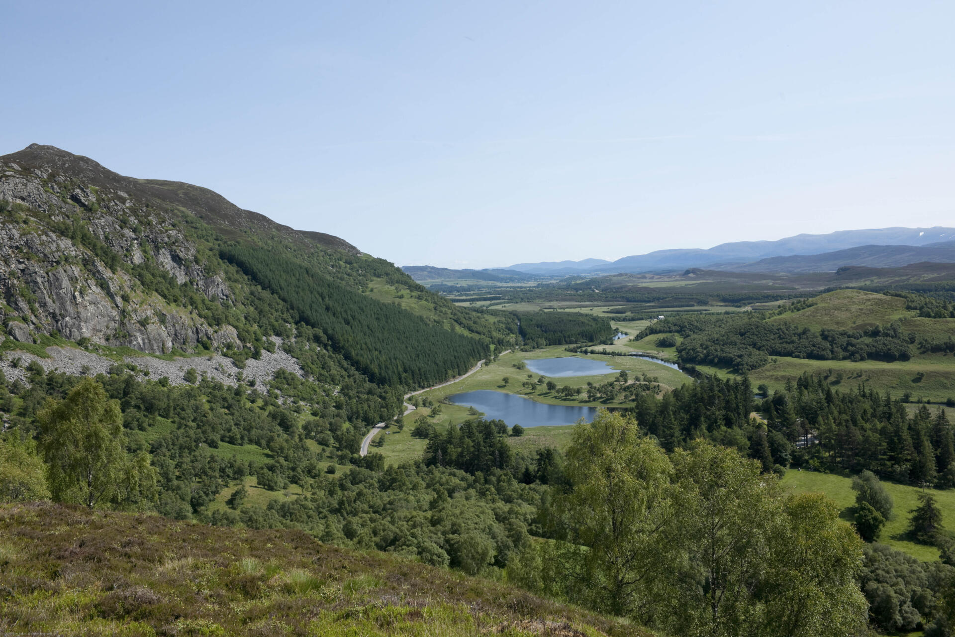
- Rough open birch forest on fairly uniform slopes either side of a spur projecting from Creag Dhubh with longer courses out on rough open moorland. Boulder fields and areas of scree. Bracken areas are generally navigable. Slow runnability for the majority.
- String
- adjacent to car parking field
- Safety
- Cagoules may be mandatory if bad weather, whistles advised. One or two Highland cows may be encountered and goats and adders may be in area. They will be more afraid of you – do not provoke if seen.
- Junior courses
- white tape will be used where routes are unclear
- Special instructions
- Day 5 includes a world Ranking Event (WRE). Courses will start from the Red start and information has been communicated in WRE bulletins. Day 5 will use the same area and courses as Day 4. To make the competition fair please do not look at Day 4 courses beforehand.
- Dogs
- are allowed in the Car Park field and there will be a dog-exercising area. The land owner’s instructions are that you must PLEASE PICK UP AND TAKE AWAY YOUR DOG EXCREMENT.
- Departure
- No exit before 1300. Take care joining the A86.
Course Information
| Course | Class | Length | Climb | Scale | Start |
| 1 | M21E | 12.7 | 610 | 1:10000 | Red |
| 2 | M21L M20L M35L | 7.6 | 360 | 1:10000 | Red |
| 2E | W21E | 7.7 | 385 | 1:10000 | Red |
| 3 | M40L M45L | 7.1 | 390 | 1:10000 | Red |
| 4 | M18L M50L | 7.0 | 315 | 1:10000 | Red |
| 5 | M16A M55L W21L | 6.1 | 275 | 1:10000 | Red |
| 6 | M21S W18L W20L W35L | 5.8 | 240 | 1:10000 | Blue |
| 7 | M60L M20S M35S W40L W45L | 5.4 | 230 | 1:10000 | Blue |
| 8 | M65L M45S M40S W50L | 5.2 | 225 | 1:7500 | Blue |
| 9 | M50S M18S W16A W21S | 4.7 | 190 | 1:7500 | Blue |
| 10 | M70L W55L | 4.6 | 180 | 1:7500 | Blue |
| 11 | M55S W60L | 4.4 | 175 | 1:7500 | Blue |
| 12 | W18S W20S W35S Green | 4.2 | 130 | 1:7500 | Green |
| 13 | M75L M60S W65L W45S W40S | 3.8 | 140 | 1:7500 | Green |
| 14 | M65S W50S | 3.4 | 125 | 1:7500 | Green |
| 15 | M70S W70L W60S W55S | 2.8 | 120 | 1:7500 | Green |
| 16 | M80 M85 M90 M75S W80 W75L W70S W65S | 2.0 | 75 | 1:7500 | Green |
| 17 | W75S W85 W90 | 1.7 | 45 | 1:7500 | Green |
| 18 | M14A M16B | 4.0 | 145 | 1:7500 | Green |
| 19 | W14A W16B Light Green | 2.7 | 130 | 1:7500 | Green |
| 20 | M12A M14B W12A W14B Orange | 2.6 | 95 | 1:7500 | White |
| 21 | M10A M12B W10A W12B Yellow | 2.4 | 50 | 1:7500 | White |
| 22 | M10B W10B White | 2.3 | 35 | 1:7500 | White |
![]()
![]()