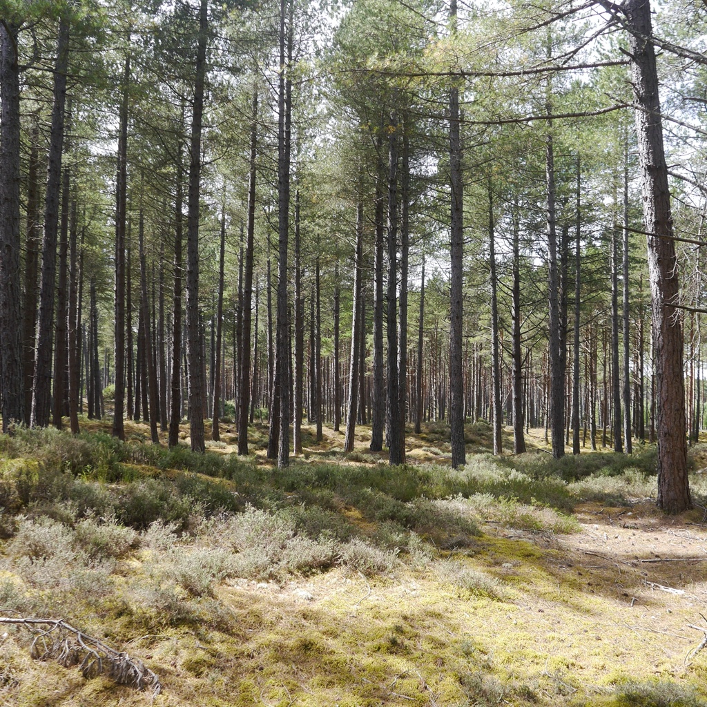
Day 1 of Moray 2023 begins with a long distance event for your fresh legs. Lossie Forest, to the east of Lossiemouth town offers technical orienteering and is the most easterly of the areas to be used for this 6 Days event. Parking and access to the forest has been arranged with kind permission of Innes Estate and Forestry and Land Scotland.
The north-western and northern part of the mapped forest consist of intricate open dunes with marram grass and pine forested dunes, together with new pine tree growth and denser gorse sections in part. The main pine forest area has an extensive path and track network.
Mapping updates were undertaken during summer 2022 to take account of damage from Storm Arwen (thankfully not extensive) as well as recent felling in the northern forested dune area which resulted in the thinning of trees and a number of new extraction lanes.
Lossie Forest was last used by the 6 Days for the opening day of Moray 2013 and the most recent large event was a SOL (Scottish O League) event in October 2021.
Location


Final Details
Important Information
- Organising clubs:
- Inverness Orienteering Club (INVOC) supported by Roxburgh Reivers (RR), Solway Orienteers (SOLWAY) and St. Andrew’s Orienteering Club Glasgow (STAG).
- Organisers:
- John Tullie (RR) & Marsela McLeod (INVOC).
- Planners:
- Iain Shepherd (INVOC) & Jon Shepherd (INVOC).
- Controllers:
- Clive Masson (TAY) & Graham McFadyen (STAG).
- Parking:
- Milltown Airfield, Lossiemouth, IV30 8NE.
- Directions:
- If travelling from Forres: Follow the A96 east to Elgin and then through Elgin as if travelling towards Aberdeen. On leaving Elgin carry on straight ahead at Barmuckity roundabout (Elgin Services/ Travellodge) and then take the first left onto the B9103 signed for Lossiemouth. After 2.8 km turn right onto an unclassified road (Urquhart / Milltown / HGV Test Centre). After 0.4 miles turn left into Milltown Airfield.
If travelling from East of Elgin: drive west on A96 towards Elgin, after you pass Lhabryde continue to the Barmuckity roundabout (Elgin Services/ Travellodge) go right round the roundabout and return along the A96 until the B9103 signed for Lossiemouth. DO NOT attempt to turn right across the A96. After 2.8 km turn right onto an unclassified road (Urquhart / Milltown / HGV Test Centre). After 0.4 miles turn left into Milltown Airfield. - Arena:
- Adjacent to parking with a 1.5 km walk to the forest entrance. A clothing dump and some toilets will be located at the forest entrance.
- Starts:
- Red, Blue and Green starts are co-located 1.2 km from the forest entrance (2.7 km flat walk in total from Arena).
White start is 600m from the forest entrance (2.1 km flat walk in total from Arena).
- Terrain:
- Intricate dunes in the coastal strip with runnable mature pine, heathery clearings and denser areas of natural regeneration and a flatter area inland with a myriad of paths, heather understorey and varied visibility.
The White Start courses use the inland area only. There are many extraction lanes throughout the area that are not mapped. Only the most significant gorse thickets have been mapped. - Safety:
- A large pond near the Red Start is mapped as Out of Bounds. It is not taped on the ground.
The ruins mapped within the coastal strip are flat concrete areas which are largely grassed over.
Runners may encounter some wire and wire mesh near the WW2 military installations (particularly near trenches, pits and pillboxes) on the coastal strip. Please take care to avoid tripping on these wires. - Junior Courses:
- TD1 and TD2 courses follow white tape for one leg where the route is less clear.
- Maps:
- Base map from PG plot (originally) and Lidar data supplied by the Scottish Orienteering Association.
Original Survey & Cartography: 1996 to present by DOLM, Trailmaps, David Ritchie, & GISamap
Event updates: DOLM, 2022-23. - Finish:
- There is a single remote finish which is 300m flat walk from the forest entrance which is 1.5 km from the arena (with a clothing dump and toilets).
- String and Off-string Courses:
- Adjacent to the Arena.
- Special Information:
- Day 1 is part of the Scottish Inter-Club Championship.
- BOF Registration Number: 81094
Final Course Lengths
| Course | Class | Length (km) | Climb (m) | Map Scale | Start |
| 1 | M10B W10B | 2.5 | 15 | 1:7,500 | White |
| 2 | M10A M12B W10A W12B | 3.3 | 20 | 1:7,500 | White |
| 3 | W12A W14B | 3.3 | 30 | 1:7,500 | White |
| 4 | M12A M14B | 3.7 | 40 | 1:7,500 | White |
| 5 | W75S W85 | 2.0 | 20 | 1:7,500 | White |
| 6 | M85 W70S W80 | 2.4 | 30 | 1:7,500 | White |
| 7 | M75S M80 W65S W75L | 2.7 | 30 | 1:7,500 | White |
| 8 | White | 2.5 | 15 | 1:7,500 | White |
| 9 | Yellow | 3.3 | 20 | 1:7,500 | White |
| 10 | Orange | 3.3 | 30 | 1:7,500 | White |
| 14 | Light Green | 3.7 | 50 | 1:7,500 | Green |
| 15 | Green | 4.6 | 90 | 1:7,500 | Green |
| 16 | W14A W16B | 3.7 | 50 | 1:7,500 | Green |
| 17 | M14A M16B | 4.9 | 90 | 1:7,500 | Green |
| 18 | M70S W55S W60S W70L | 3.5 | 70 | 1:7,500 | Green |
| 19 | M65S W50S | 4.0 | 70 | 1:7,500 | Green |
| 20 | M75L W45S W65L | 4.3 | 80 | 1:7,500 | Green |
| 21 | M60S W40S | 4.7 | 90 | 1:7,500 | Green |
| 22 | W18S W20S W35S | 4.6 | 90 | 1:10,000 | Green |
| 23 | M55S W60L | 5.0 | 100 | 1:7,500 | Blue |
| 24 | M70L W55L | 5.4 | 130 | 1:7,500 | Blue |
| 25 | M18S W16A W21S | 5.6 | 150 | 1:10,000 | Blue |
| 26 | M50S | 5.7 | 160 | 1:7,500 | Blue |
| 27 | M45S W50L | 6.0 | 155 | 1:7,500 | Blue |
| 28 | M40S M65L | 6.2 | 130 | 1:7,500 | Blue |
| 29 | M20S M35S W45L | 6.3 | 120 | 1:7,500 | Blue |
| 30 | M60L W40L | 6.9 | 150 | 1:7,500 | Blue |
| 31 | M21S W18L W20L W35L | 7.4 | 155 | 1:10,000 | Blue |
| 34 | M16A W21L | 7.5 | 205 | 1:10,000 | Red |
| 35 | M55L | 7.6 | 180 | 1:7,500 | Red |
| 36 | M18L M50L | 8.9 | 220 | 1:7,500 | Red |
| 37 | M45L | 8.8 | 220 | 1:7,500 | Red |
| 38 | M40L | 9.3 | 225 | 1:10,000 | Red |
| 39 | M20L M21L M35L | 9.5 | 265 | 1:10,000 | Red |
| 40 | W21E | 9.2 | 310 | 1:10,000 | Red |
| 41 | M21E | 11.8 | 350 | 1:10,000 | Red |
Thanks to the landowners who have made today’s event possible…
| Forestry and Land Scotland | Innes Estate, Elgin |