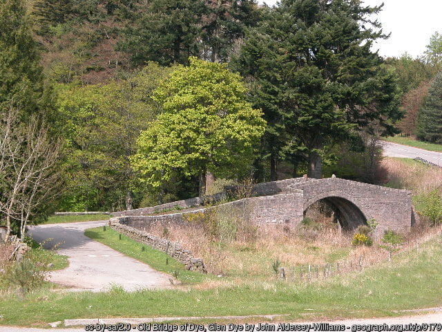
Glen Dye is a large classic Deeside forest, close to Aberdeen and is very popular for all scales of orienteering events. Surprisingly it has not been used for the Scottish 6 Days since 2005 but the last Major event was the Scottish Championships in 2022.
The area contains the full range of terrain one expects on Deeside. The valley floor comprises complex moraine contour detail in mature coniferous forest while the steep valley sides have abundant rock detail. Visibility and runnability varies greatly across the area adding to the complexity.
Clear felling and storm damage has reduced the area recently but there is still a bewildering variety of challenges in this quality orienteering terrain.
Glen Dye is used with the kind permission of Glen Dye Estate.
For the elite classes only, this will be a Long Distance World Ranking Event.
Location


Final Details
Important Information
- Organising clubs
- Interlopers Orienteering Club (INT), Grampian Orienteers (GRAMP) & Badenoch and Strathspey Orienteering Club (BASOC)
- Organisers
- Colin Eades (INT) & Janette Macleod (BASOC)
- Planners
- Rob Hickling (BASOC) & Ian Hamilton (GRAMP)
- Controllers
- Trevor Hoey (FVO) & Paul Caban (INT)
- Directions
- Parking is off a minor road (labelled the Old Military Road on some maps) at Cuttieshillock, 1 mile (1.5km) south of the (B976). This short section of road will be used by residents and vehicles approaching the event before 12:30 and exiting after 13:00.
If approaching from Ballater and Braemar follow the A93 eastwards to Dinnet and cross the Dinnet Bridge to the B976 (South Deeside Road). Turn left and follow the B976 for 13 miles (22km) past the closed Aboyne Bridge and through Birse, Ballogie and Finzean to Feughside. Turn right and follow the minor road. After 1 mile (1.5km) turn left to follow an unmetalled track for a further 500m to parking.
If approaching from Aboyne follow the A93 for 7 miles (11km) eastwards from Aboyne, passing through Kincardine O’Neil to Potarch Bridge. Turn right to cross the bridge then immediately left to follow the Old Military Road for 4 miles (6km), signposted towards the Cairn O’Mount. At Feughside turn right and immediately left to follow the minor road for 1 mile (1.6km) to the turn off for parking
If approaching from Banchory cross the Dee Bridge at Banchory and follow the B974 (South Deeside Road). After 3 miles (5km), at Strachan, continue straight on onto the B976 and after 2 miles (3km), at Feughside, turn left to follow the minor road 1mile (1.6km) to the turn off for parking.
If approaching from Fettercairn follow the B974 Cairn O’Mount road to Strachan. Turn left and follow the same directions as traffic approaching from Banchory. Please note that the minor road on the left at the AA box is closed for the event.
Competitors will not be allowed to arrive after 12:30 or leave before 13:00. - Parking
- GR: NO 646 910
W3W: tunnel.workroom.shadows
Post Code: AB31 6LU - Arena
- Adjacent to parking.
- Starts
- Routes to all starts leave the arena to the South. After 300m, all pass through a gate after which the route to the Elite start turns North for a further 300m (20m climb). The Red, White, Green and Blue starts are a further 500m (total ascent 30m), which includes a short (<100m) section up a moderately steep bank. 100m before the starts is a flat waiting area in open land; Red start is North of this area, and White, Green and Blue share a common start south of the waiting area. Note that there is no shelter or shade here.

- Maps
- Previous maps by Deeside Orienteering and Leisure Maps (DOLM) and Stirling Surveys. Revised and extended for Royal Deeside 2025 by DOLM 2024/25. © GRAMP.
Courses 1E & 2E use a scale of 1:15,000; courses 2 to 6 use a scale of 1:10,000; and all other courses use a scale of 1:7,500.
View old map on Routegadget - Terrain
- Large open conifer plantation with a variety of rock features, moraines, contour and water detail. The longer courses will extend into a newly mapped extension of lower visibility, runnable forest with good rock detail. Parts of the forest have been thinned and felled recently leaving extraction lanes that have not been mapped for the purposes of clarity. Also, recent storm damaged windblown trees have been mapped with an orientated dark green uncrossable symbol. Some areas of heather, bracken and bog myrtle may also be encountered. There are piles of timber alongside some recently felled areas that must not be crossed – the most prominent of these are mapped as solid green lines. Those who think that they know Glen Dye well can expect a few surprises.
- Finishes
- The Finish is in the arena.
- String and off-string courses
- Adjacent to the NE corner of the car parking, approximately 200m from the arena.
- Safety
- There is a public road through the centre of the area that will be closed to all but the few residents along the road. All but the shortest courses cross this road twice and care must be taken when approaching it. Forestry operations have been taking place in the forest fairly recently so any machinery, log piles or other evidence of work must be avoided.
- Pools which are mapped as uncrossable water features must be avoided.
- Junior courses
- The shortest courses cross a small burn which may mean wet feet and will be marshalled.
- Courses 22 and 23 follow paths tracks and fences with a fence crossing and some tapes between controls -in these stretches, smiley faces will help competitors know that they are going the correct way.
- BOF Registration No.: 84586
- Special Information
- Day 5 is a Long Distance World Ranking Event for elite classes. View IOF Bulletin 2.
- Drinks stations are marked on Elite course maps only – competitors on other courses may encounter drinks stations but must not take drinks as we must not run short for the WRE competitors who have to run for at least 90 minutes.
- There is a warm-up area for Elite competitors that is close to all of the other starts.
- All non-elite competitors can warm-up alongside the tracks on the routes to the starts, but must not cross any red/white tapes.

Final Course Lengths
| Course | Class | Length (km) | Climb (m) | Controls | Start |
|---|---|---|---|---|---|
| 1E | M21E | 13.5 | 365 | 28 | Elite |
| 2E | W21E | 10.4 | 340 | 24 | Elite |
| 2 | M20L M21L M35L | 7.1 | 210 | 26 | Red |
| 3 | M40L M45L | 6.9 | 185 | 24 | Red |
| 4 | M18L M50L | 6.5 | 185 | 21 | Red |
| 5 | M16A M55L W21L | 5.6 | 145 | 20 | Red |
| 6 | M20S M21S M35S W20L W18L W35L | 5.4 | 145 | 17 | Blue |
| 7M | M60L W40L | 5.1 | 150 | 16 | Blue |
| 7W | W45L | 5.0 | 160 | 16 | Blue |
| 8M | M65L M40S | 4.6 | 150 | 14 | Blue |
| 8W | W50L | 4.6 | 150 | 16 | Blue |
| 9 | M18S M45S M50S W16A W21S | 4.2 | 140 | 16 | Blue |
| 10M | M70L | 3.9 | 120 | 14 | Blue |
| 10W | W55L | 3.9 | 120 | 14 | Blue |
| 11 | M55S W20S W18S W60L | 3.8 | 125 | 13 | Blue |
| 12 | Green W35S | 3.6 | 120 | 15 | Green |
| 13 | M75L W65L W40S | 3.3 | 105 | 11 | Green |
| 14 | M60S M65S W45S W50S | 3.2 | 105 | 12 | Green |
| 15 | M70S W70L W55S W60S | 3.1 | 75 | 14 | Green |
| 16 | M80 M75S W75L W65S | 2.2 | 50 | 11 | Green |
| 17 | M85 W80 W85 W70S W75S | 1.9 | 35 | 9 | Green |
| 18 | M14A M16B | 3.7 | 130 | 14 | Green |
| 19 | Light Green W14A W16B | 2.9 | 105 | 13 | Green |
| 20 | Red | 4.6 | 110 | 13 | White |
| 21 | Orange M12A M14B W12A W14B | 2.9 | 60 | 13 | White |
| 22 | Yellow M10A M12B W10A W12B | 2.6 | 35 | 14 | White |
| 23 | White M10B W10B | 2.1 | 20 | 13 | White |
Thanks to…![]()
![]()